This post is also available in:
![]() Deutsch
Deutsch ![]() Русский
Русский ![]() Français
Français ![]() Italiano
Italiano ![]() Português
Português ![]() Español
Español
The climate of Norway is subpolar as regards latitude, but with particularly mild temperatures thanks to the action of the warm Gulf Stream, a branch of which runs entirely along the Norwegian coast and ensures that surface waters never freeze. The temperatures, thanks to the influences of the Gulf Stream, are relatively mild. The Norwegian climate is different from that of the rest of Scandinavia, the mountain ranges protect the eastern part of the country which receives little rainfall.
PRECIPITATIONS
Precipitation is abundant especially on the coasts, while decreasing inland. Along the coast, the rainiest months are the autumn and winter ones. Some eastern areas of the country receive less than 300mm of rain per year. The rains, brought by the Atlantic winds, decrease from the coastal area (where in some south-western coastal areas even exceed 2,000 mm per year) towards the interior. In Finnmark there are often values less than 500 mm per year. Snowfall is frequent, the coldest months of the year are January and February.
TEMPERATURES
The internal highlands have a type of Arctic climate, with snowy winters, strong winds and strong frosts. But sometimes during the summer, maximum temperatures can rise above 30 ° C, with long hours of sunshine. The hottest period in the interior of the country is between mid-July and August. The milder climate occurs along the coast and in the south of the country. Average temperatures in Oslo are: -3 / -4 ° C in winter and + 18 / + 19 ° C in summer.
Norway is the land of the midnight sun in the North Cape area, with 24 hours of light a day from mid-May until the end of July, during which the sun does not set. Conversely, there are long winter nights from the end of November until the end of January, during which the sun never rises above the horizon, in this period the northern lights can be seen.
THE BENEFICIAL EFFECTS OF THE GULF STREAM
The climate of Norway, due to its position in the far north of Europe, practically at the same latitude as Alaska and Greenland, is often believed to be cold and humid, but Norway, thanks to the beneficial influence exerted by the warm Gulf Stream has a much milder climate than those areas of the planet.
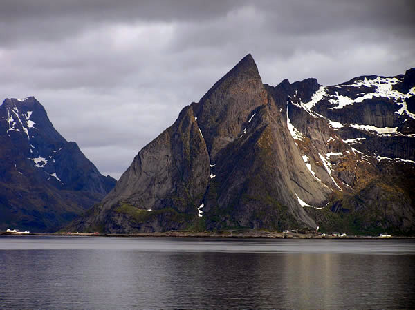
The Norwegian climate is in fact temperate or sub-arctic. Specifically, the southwestern coastal area between Kristiansand and Bergen has a temperate maritime climate. The area around the capital, Oslo, has a humid continental climate. The elevated interior areas have a subarctic continental climate. The whole north-western coast from the Lofoten islands to Tromsø has a subpolar oceanic maritime climate. While only the extreme offshoot of the north coast, the Svalbard islands and the Jan Mayen island have a polar climate.
A VERY DIFFERENT CLIMATE ACCORDING TO LATITUDE
Norway has a very different climate between the various areas of the country, this is mainly due to three factors: the enormous extension of the country from north to south, its orography with mountains that reach the sea, and the different insolation in the various times of the year. In fact in large areas of the country during the winter months the sun never rises and on the other hand during the summer months the sun never sets, causing the famous phenomenon of the Midnight Sun.
Along the southern coast and in some inland areas of the south, during the summers there are mild average temperatures that reach and exceed, during the day, even 20 ° C. In Oslo for example, the average maximum temperature in July is 21.5 ° C. The southernmost of the Lofoten islands, which lie beyond the Arctic circle, are the northernmost place on earth where the average temperatures of the winter months are always above zero. The coldest areas of the country, excluding mountain areas and the Svalbard islands, are the inland areas of Norwegian Lapland. Here the average annual temperatures vary between -2 ° C and -3 ° C. In winter in Norwegian Lapland the minimum temperatures can even reach -30 ° C or -40 ° C
PRECIPITATIONS
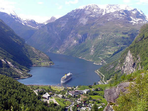
As regards rainfall, there are great differences between the various areas of the country. These differences are also due to the conformation of the Norwegian territory with high mountains close to the sea. The rainiest areas of the country are the western coastal areas where most of the rains occur during the autumn and winter. The area of the southwestern fjords is by far the rainiest region in Norway. There are also peaks of over 3,500 mm of rain per year here. By contrast, the rainiest months are the summer months in the central, south-eastern areas and in Norwegian Lapland. In some of these areas, rainfall is very low, with annual averages that are below 300-400 mm.
Snow falls throughout the country during the winter months. Large areas of Norway are covered by snow for at least three months a year.

WHEN TO GO TO NORWAY
The best time to travel to Norway are the summer months of June, July and August. These months are in fact characterized by mild climate and long hours of light. These are also the most popular months for tourists, so it is better to book hotels and accommodation early. Even May and September can be excellent months to visit the country avoiding the period of greatest tourist influx.
Climate of the Lofoten islands.
The North Cape climate.
Climate of the Svalbard islands.
The Norwegian Meteorological Institute page.
[divider]
[divider]
[divider]
[divider]
THE CLIMATE OF NORWAY: CLIMATE TABLES
[divider]
| OSLO (23 meters) | ||||
| Month | Average low (°C) | Average high (°C) | Precip. (mm) | Precip. days |
| January | -6,8 | -1,8 | 49 | 6 |
| February | -6,8 | -0,9 | 36 | 4 |
| March | -3,3 | 3,5 | 47 | 6 |
| April | 0,8 | 9,1 | 41 | 5 |
| May | 6,5 | 15,8 | 53 | 5 |
| June | 10,6 | 20,4 | 65 | 7 |
| July | 12,2 | 21,5 | 81 | 7 |
| August | 11,3 | 20,1 | 89 | 8 |
| September | 7,5 | 15,1 | 90 | 7 |
| October | 3,8 | 9,3 | 84 | 8 |
| November | -1,5 | 3,2 | 73 | 8 |
| December | -5,6 | -0,5 | 55 | 6 |
| YEAR | 2,4 | 9,6 | 763 | 77 |
[divider]
| BERGEN (12 meters) | ||||
| Month | Average low (°C) | Average high (°C) | Precip. (mm) | Precip. days |
| January | -0,4 | 3,6 | 190 | 20 |
| February | -0,5 | 4,0 | 152 | 15 |
| March | 0,9 | 5,9 | 170 | 17 |
| April | 3,0 | 9,1 | 114 | 13 |
| May | 7,2 | 14,0 | 106 | 14 |
| June | 10,2 | 16,8 | 132 | 11 |
| July | 11,5 | 17,6 | 148 | 15 |
| August | 11,6 | 17,4 | 190 | 17 |
| September | 9,1 | 14,2 | 283 | 20 |
| October | 6,6 | 11,2 | 271 | 22 |
| November | 2,8 | 6,9 | 259 | 17 |
| December | 0,6 | 4,7 | 235 | 21 |
| YEAR | 5,2 | 10,5 | 2250 | 202 |
[divider]
| SVOLVAER, LOFOTEN (3 meters) | ||||
| Month | Average low (°C) | Average high (°C) | Precip. (mm) | Precip. days |
| January | -0,7 | 1,5 | 143,8 | 20 |
| February | -1,9 | 0,6 | 111,7 | 18 |
| March | -0,7 | 1,4 | 95,8 | 17 |
| April | 2,2 | 4,4 | 92,1 | 13 |
| May | 5,8 | 8,6 | 79,0 | 16 |
| June | 9,3 | 12,2 | 59,8 | 12 |
| July | 12,4 | 15,4 | 66,8 | 14 |
| August | 11,9 | 14,4 | 66,8 | 14 |
| September | 9,0 | 11,1 | 83,3 | 15 |
| October | 5,4 | 7,3 | 129,0 | 17 |
| November | 2,5 | 4,6 | 134,1 | 15 |
| December | 0,5 | 2,6 | 147,8 | 17 |
| YEAR | 4,6 | 7,0 | 722,2 | 188 |
[divider]
This post is also available in:
![]() Deutsch
Deutsch ![]() Русский
Русский ![]() Français
Français ![]() Italiano
Italiano ![]() Português
Português ![]() Español
Español


