This post is also available in:
![]() Deutsch
Deutsch ![]() 日本語
日本語 ![]() Français
Français ![]() Italiano
Italiano ![]() Português
Português ![]() Español
Español
The Northeast of Brazil, that is the Brazilian territory located between the states of Bahia and Maranhão, has an arid climate. Indeed this is the driest region in the country. In this region of the country the rainy season is concentrated in the months between January and July. Average temperatures are around 31 ° C, but maximum temperatures sometimes exceed 38 ° C.
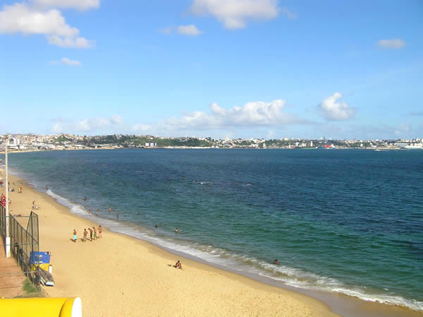
The coastal areas of the Brazilian Northeast region have a tropical climate with abundant rainfall. Temperatures are very high along the coast and rainfall decreases towards the interior of the region. The annual average rainfall for Salvador is 2,100 mm, but in the interior of the region the rainfall decreases drastically.
The areas of the so-called Brazilian sertão have a semi-arid climate with low humidity, low rainfall and a long dry season. Average annual rainfall is about 750 mm. But the rain falls very irregularly, making agriculture difficult in these regions. In some areas of the São Francisco river basin, rainfall does not exceed 500 mm per year, while temperatures reach very high values.
CLIMATE IN THE VARIOUS AREAS OF NORTHEAST OF BRAZIL
Climate of Fernando de Noronha.
Climate of Rio Grande do Norte.
[divider]
[divider]
[divider]
THE CLIMATE OF NORTHEAST OF BRAZIL: CLIMATIC TABLES
[divider]
CLIMATE TABLES: SALVADOR
[divider]
| SALVADOR (8 meters) | ||||
| Month | Average low (°C) | Average high (°C) | Precip. (mm) | Precip. days |
| January | 23,6 | 29,9 | 138,0 | 10 |
| February | 23,7 | 30,0 | 142,0 | 13 |
| March | 23,9 | 30,0 | 151,6 | 16 |
| April | 23,7 | 28,6 | 309,7 | 17 |
| May | 22,9 | 27,7 | 359,9 | 20 |
| June | 22,0 | 26,5 | 243,7 | 19 |
| July | 21,4 | 26,2 | 175,0 | 20 |
| August | 21,2 | 26,4 | 127,4 | 15 |
| September | 21,7 | 27,2 | 102,0 | 12 |
| October | 22,5 | 28,1 | 114,9 | 10 |
| November | 22,9 | 28,9 | 137,1 | 11 |
| December | 23,2 | 29,0 | 142,8 | 10 |
| YEAR | 22,7 | 28,2 | 2144 | 173 |
[divider]
CLIMATE TABLES: RECIFE
[divider]
| RECIFE (5 meters) | ||||
| Month | Average low (°C) | Average high (°C) | Precip. (mm) | Precip. days |
| January | 22,4 | 30,2 | 108,2 | 10 |
| February | 22,6 | 30,2 | 148,2 | 11 |
| March | 22,7 | 30,0 | 256,9 | 16 |
| April | 22,6 | 29,7 | 337,6 | 18 |
| May | 21,9 | 28,9 | 318,5 | 20 |
| June | 21,6 | 27,9 | 377,9 | 21 |
| July | 21,1 | 27,3 | 388,1 | 22 |
| August | 20,6 | 27,5 | 204,8 | 17 |
| September | 20,7 | 28,1 | 122,0 | 13 |
| October | 21,4 | 29,0 | 63,0 | 9 |
| November | 21,9 | 30,1 | 35,7 | 6 |
| December | 22,2 | 30,2 | 56,8 | 8 |
| YEAR | 21,8 | 29,1 | 2417,6 | 171 |
[divider]
CLIMATE TABLES: NATAL
[divider]
| NATAL (30 meters) | ||||
| Month | Average low (°C) | Average high (°C) | Precip. (mm) | Precip. days |
| January | 24,0 | 30,2 | 54,6 | 6 |
| February | 23,8 | 30,5 | 87,3 | 9 |
| March | 23,3 | 30,3 | 195,8 | 14 |
| April | 22,8 | 29,8 | 264,7 | 16 |
| May | 22,3 | 29,1 | 239,6 | 14 |
| June | 21,5 | 28,2 | 202,2 | 16 |
| July | 20,8 | 27,7 | 196,9 | 17 |
| August | 20,7 | 27,9 | 112,6 | 13 |
| September | 21,7 | 28,6 | 59,1 | 8 |
| October | 22,7 | 29,5 | 17,1 | 4 |
| November | 23,1 | 29,7 | 14,7 | 4 |
| December | 23,6 | 30,2 | 20,8 | 5 |
| YEAR | 22,5 | 29,3 | 1465,4 | 126 |
[divider]
CLIMATE TABLES: SÃO LUIS DO MARANHÃO
[divider]
| SÃO LUIS DO MARANHÃO (4 meters) | ||||
| Month | Average low (°C) | Average high (°C) | Precip. (mm) | Precip. days |
| January | 23,5 | 30,0 | 244,2 | 13 |
| February | 23,1 | 29,4 | 373,0 | 17 |
| March | 23,0 | 29,4 | 428,0 | 23 |
| April | 23,1 | 29,6 | 475,9 | 22 |
| May | 23,1 | 30,1 | 316,5 | 20 |
| June | 22,9 | 30,4 | 173,3 | 13 |
| July | 22,6 | 30,2 | 131,1 | 10 |
| August | 23,0 | 30,7 | 29,4 | 4 |
| September | 23,5 | 31,0 | 23,3 | 2 |
| October | 23,7 | 31,2 | 7,6 | 1 |
| November | 24,0 | 31,4 | 10,5 | 1 |
| December | 24,0 | 31,1 | 77,2 | 4 |
| YEAR | 23,3 | 30,4 | 2290,0 | 130 |
[divider]
This post is also available in:
![]() Deutsch
Deutsch ![]() 日本語
日本語 ![]() Français
Français ![]() Italiano
Italiano ![]() Português
Português ![]() Español
Español
